|
Day 15: Into Thin Air in the Mercantour National Park
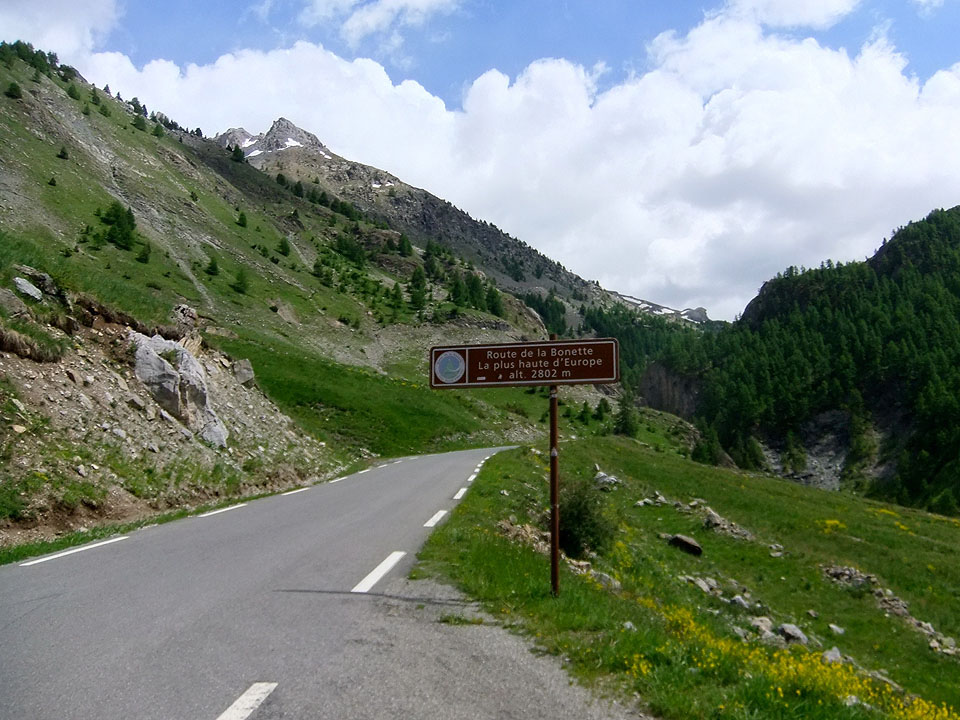
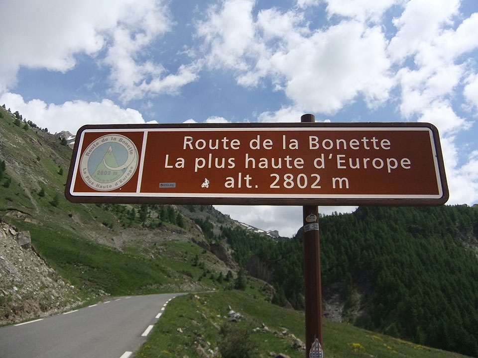
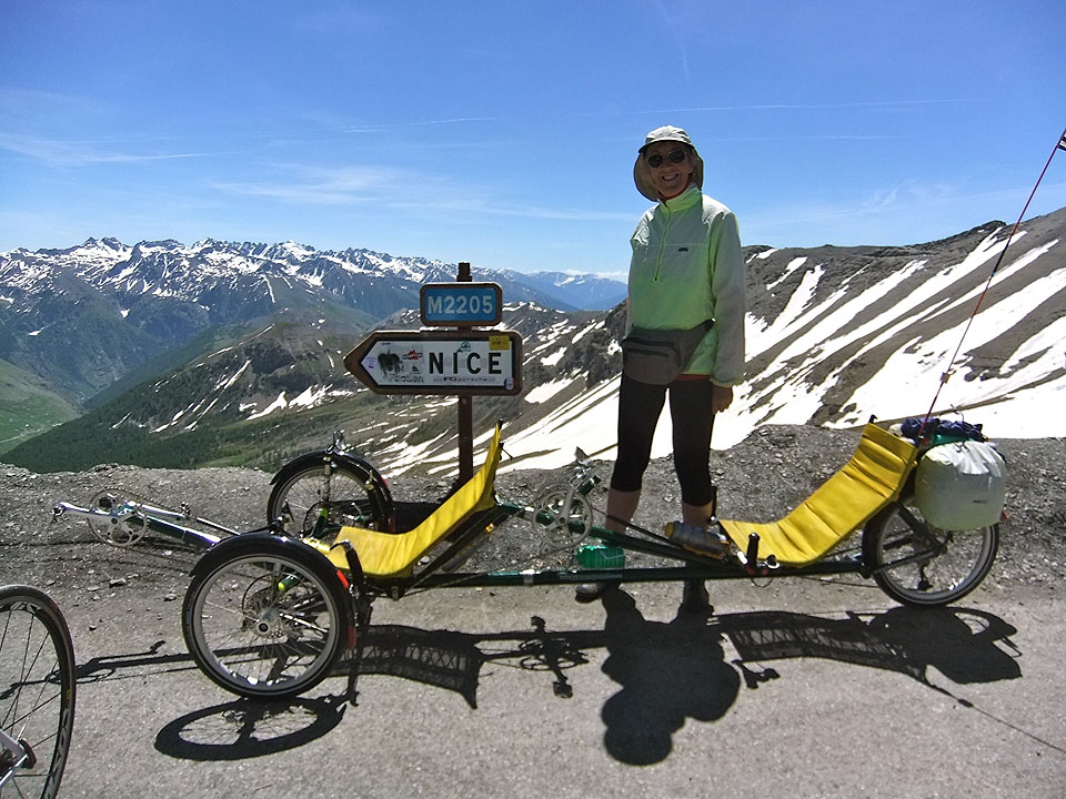
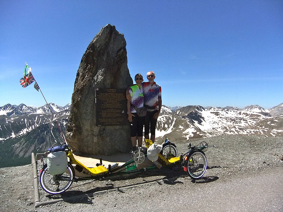
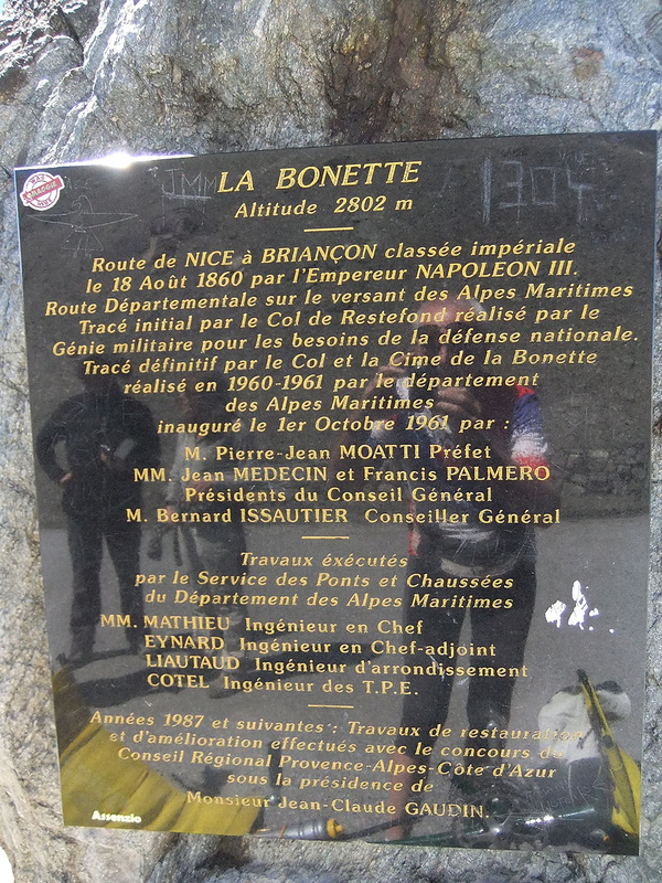
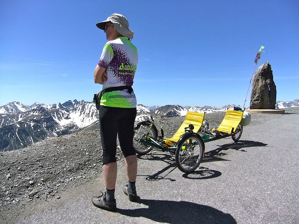
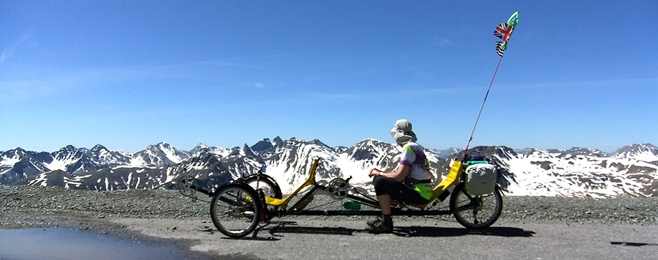
Col de la Bonette TdF HC 2,715m La Plus Haute d'Europe 2,802m 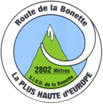
The Col de la Bonette features in today’s itinerary and there is often some confusion about its height and status. Also much of our holiday cycling was about Cols this year. So, before describing our attempt to take a recumbent tandem trike to the top of Europe, we will start with an explanation of some of the arcane law appertaining to collecting Cols.
Should you be interested, pay attention: Just as some hill walkers spend years “bagging” Munros in Scotland, there are cyclists who collect Cols. Like so many things to do with cycling the organisation that regulates such activity is French. it is the Ordre des Cols Dur (OCD). The chaps who run it also have OCD tendencies in devising their arcane rules. Mostly it is about the Alps and Pyrenées, but may involve mountains anywhere in the world.
Got all that? We will explain about the Col de la Bonette in a minute, but first there is some other information about high level Col collecting you should have: Our locally produced guide to Alpine Cols helpfully explains that if you live at sea level (e.g. our home in Lymington) your VO2 MAX will be reduced by about 15% at 2,500m, which is a smart way of saying you’re going to be short of breath even before you do anything energetic or daft like cycling up hill – gee thanks for turning down the oxygen. Getting enough oxygen into your system is all about pacing yourself. The guide we were given to make sure that we were setting ourselves an appropriately steady pace involves two tests.
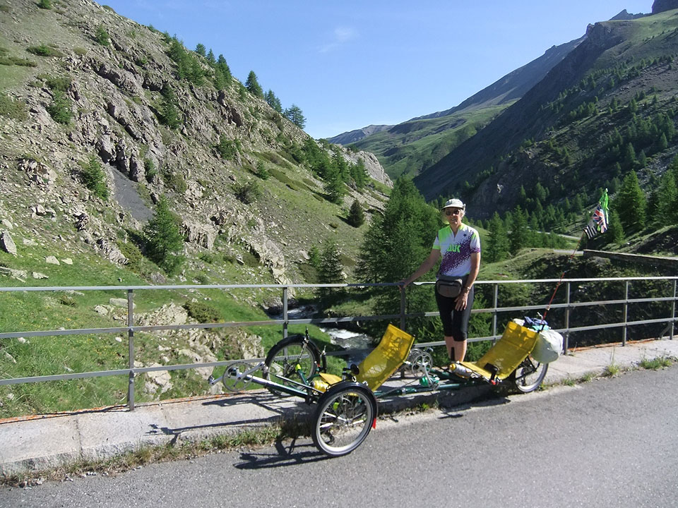
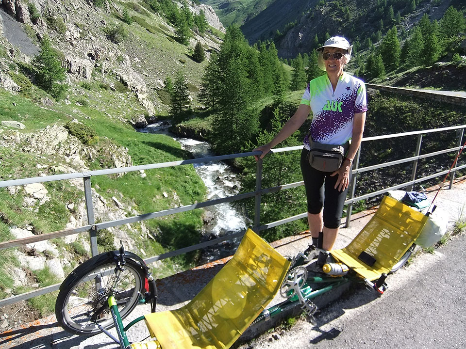
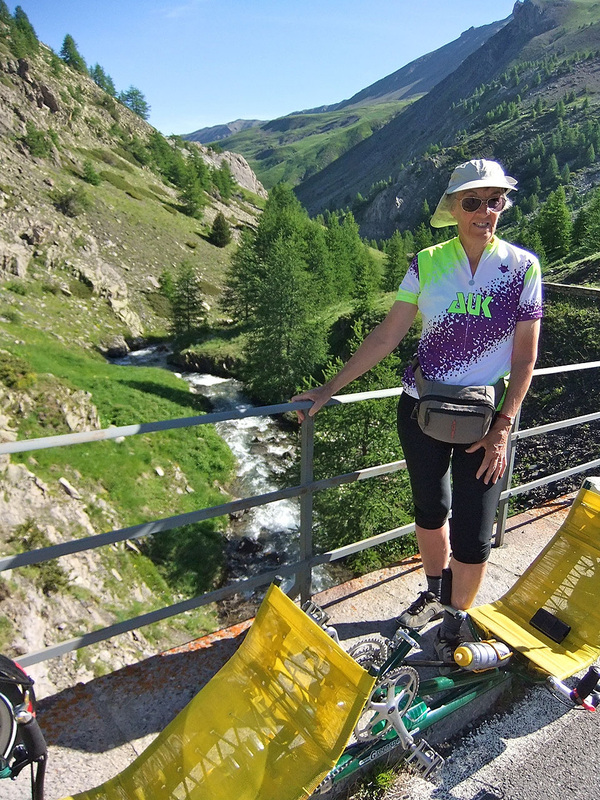
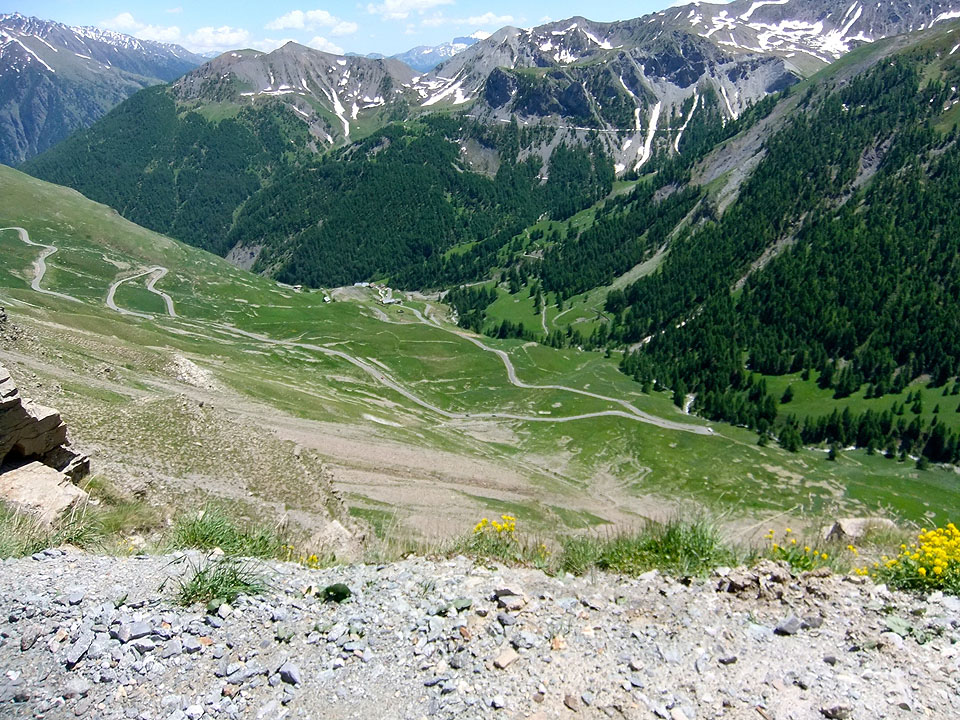
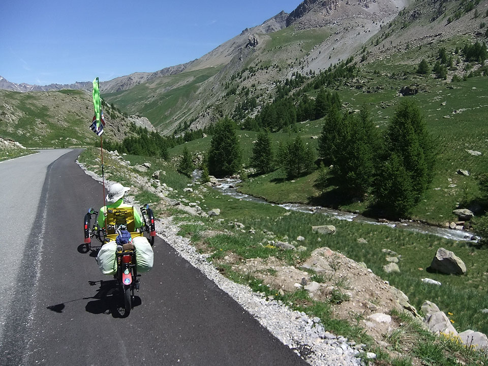
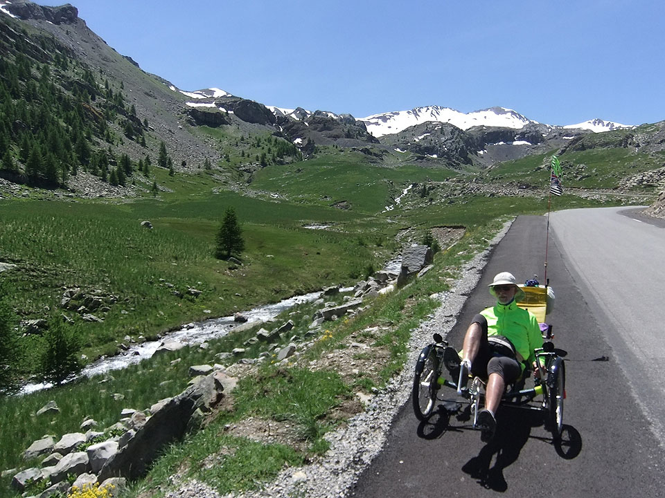
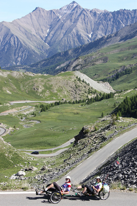
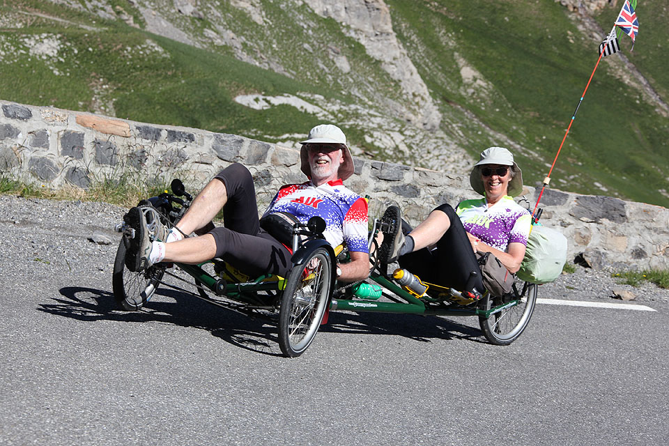
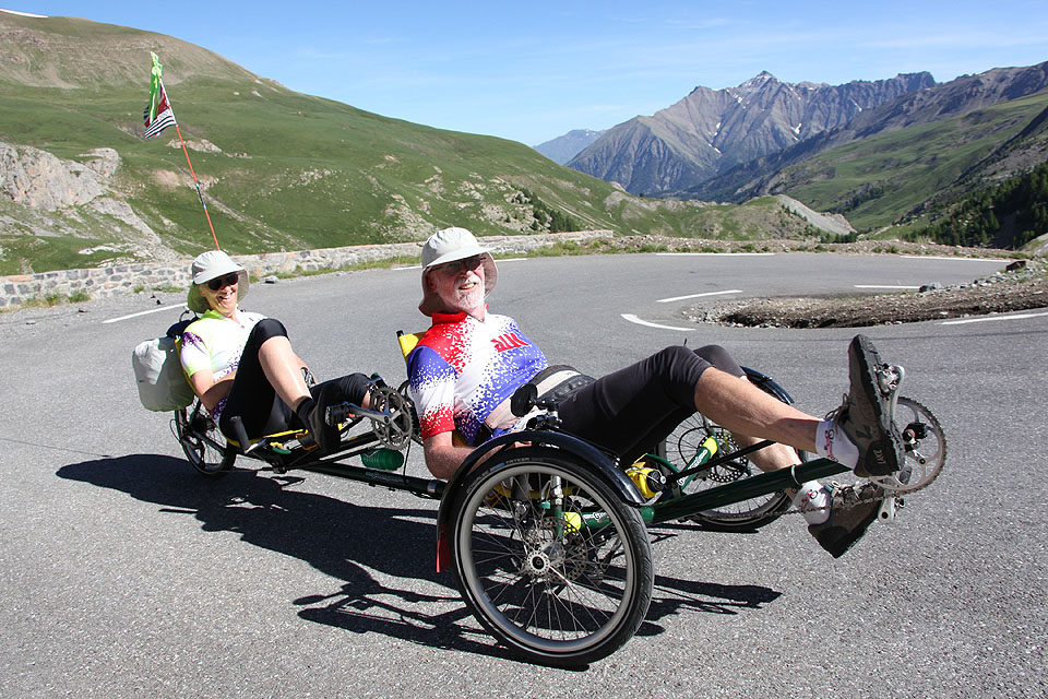
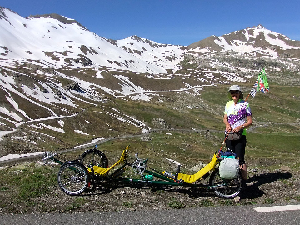
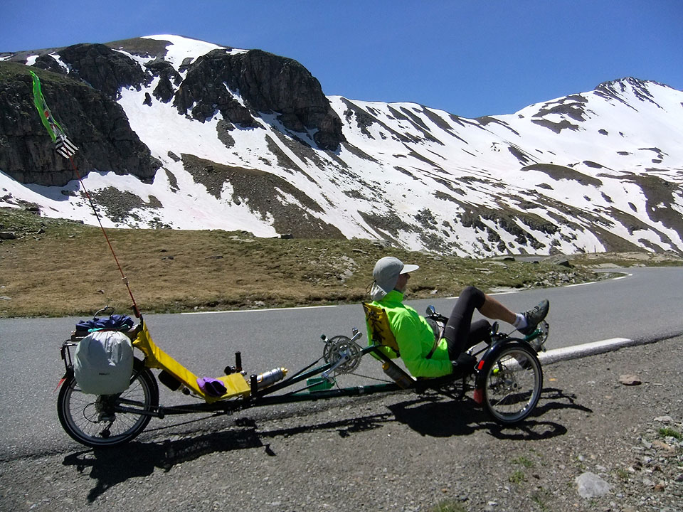
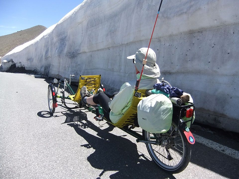
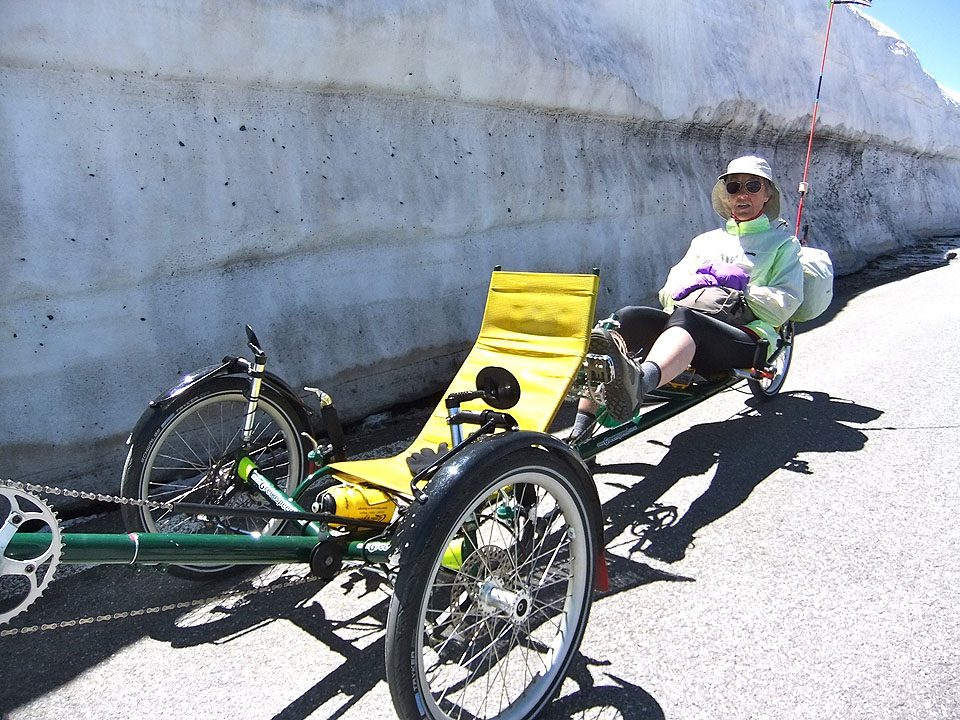
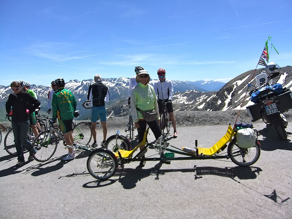
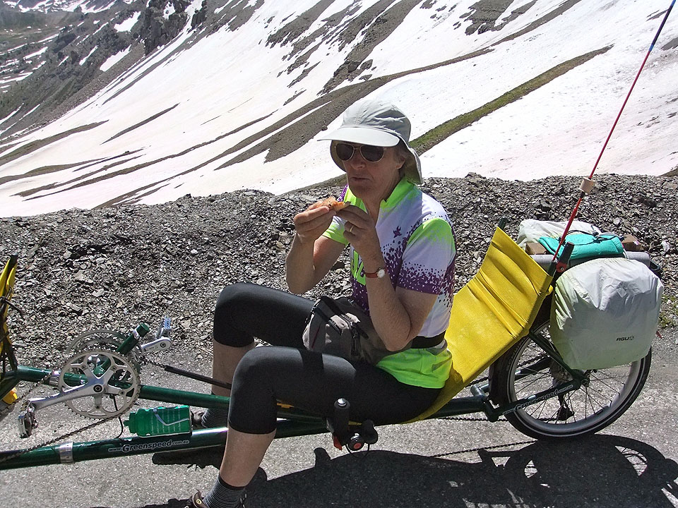
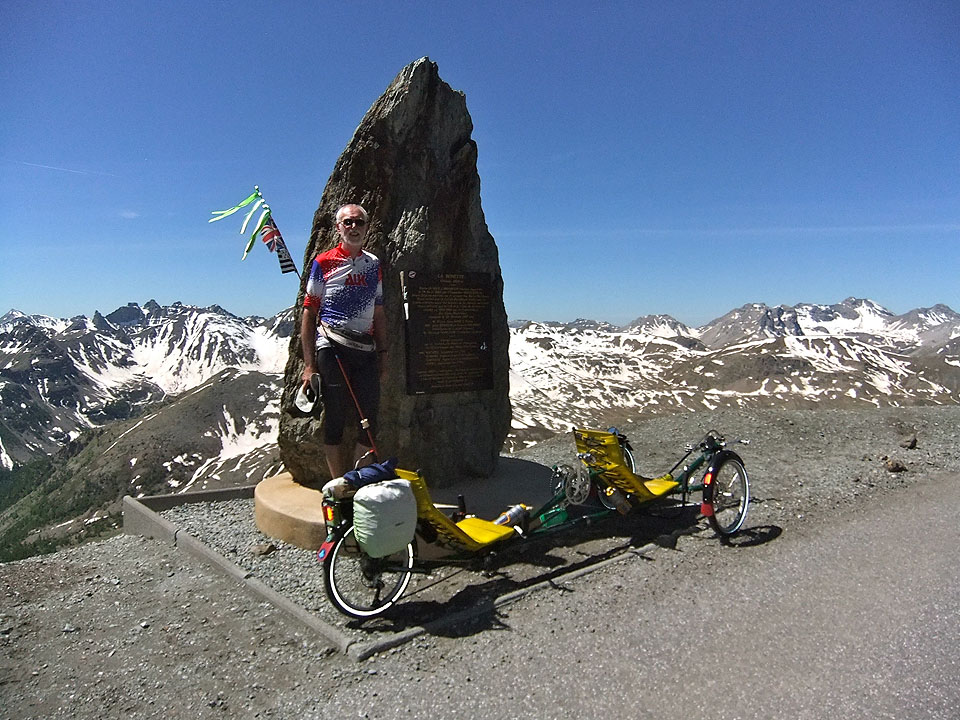
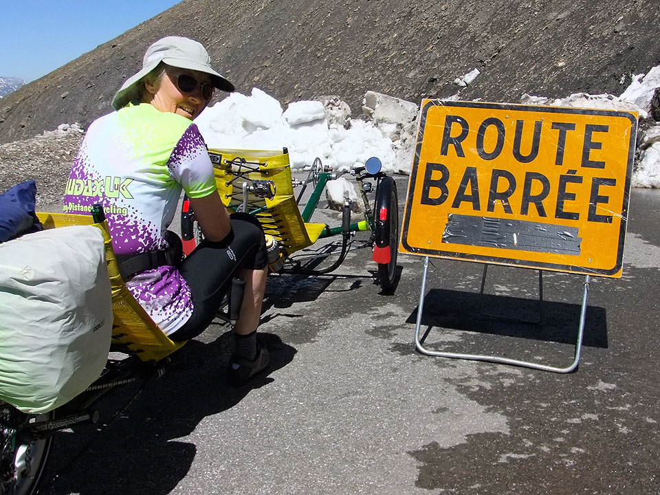
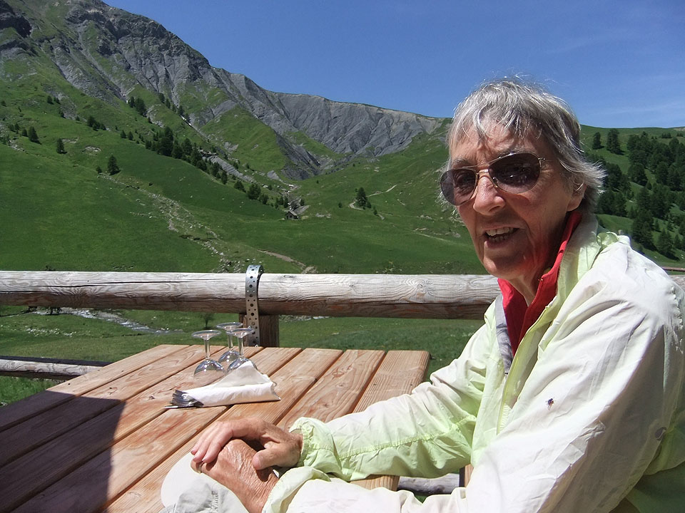
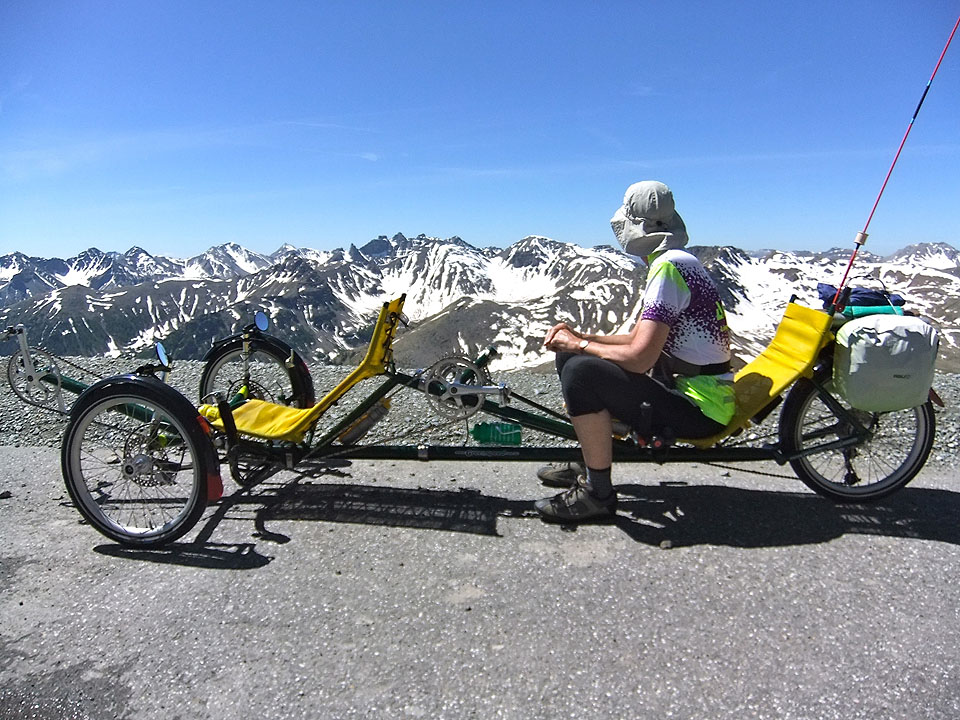
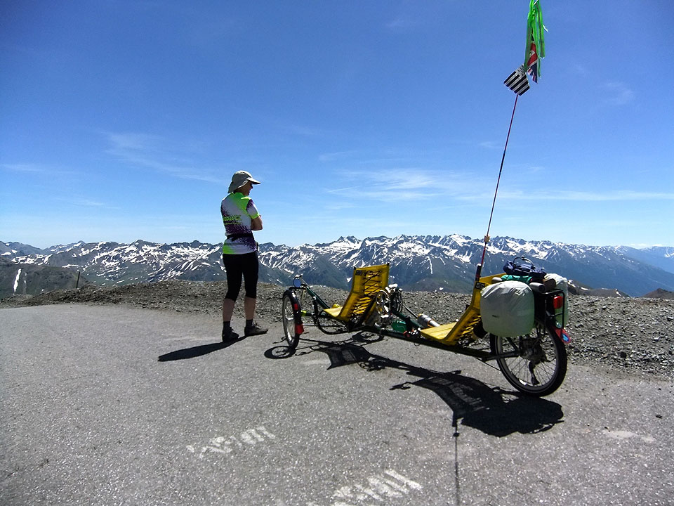
The other practical demonstration of reducing air pressure is the crisp bag test. If you fancy taking a salty snack and buy a bag of crisps in Barcelonnette, and pop it in your back pocket (or on a recumbent your tum bag), the bad news is that it will have exploded due to reducing air pressure before you get to the top of the Col de la Bonette. This also posed the dilemma of should we reduce the pressure in our tyres as required by airlines shipping bikes in un-pressurised aircraft holds? You will have to work this out for yourself, but as we are now safely back down with no exploded tyres on the trike, we obviously made the right decision. Now what about our Mercantour tandem tricycle excursion – read on: It was as near perfect weather as it would be possible to have. There was a blue sky and sunshine blazing down, but cold mountain air keeping the temperature down and no wind to speak of. The goal of the day was to cycle within the Mercantour National Park to the top of the Col de la Bonette (A TdF HC climb, although only occasionally used as part of the TdF route) and then on to a personal road cycling “high point” by cycling to the summit point on the highest paved road in Europe. The road junction at the Col de la Bonette involves the roads from Jausiers and from Nice, together with the two ends of a road that circles around la Cime de la Bonette mountain top. The Col at the Nice and Jausiers roads junction is 2,715m high, which makes it the second highest Col in France being a spit lower than the Col d’Iseran. The road encircling the mountain top climbs to 2,802m ( or as Sheila prefers 9,200ft). It complies with OCD rules 1 to 4, but because it fails rule 5 no Col claim is allowed, just the glory of cycling altitude achievement. Aspects of the scenery were different once again, but ‘awesome’, breathtakingly beautiful and of course big were all appropriate expressions. A twisty turning road climbed away from the valley including some sections of clambering up hairpin bends. The route progressed from quite steep rocky valleys opening onto high Alpine pasture with small tinkling steams created by a sequence of glacier formed hanging valleys. On the way back down Sheila became a bit overcome with some Heidi or Sound of Music moments. There were loads of small gentians mixed in with yellow violas and heaps of little white jobs whose name we do not know. Marmot spotting took off in a big way during the middle part of the climb – sitting up and whistling, crossing the road and giving us a wary looking over. Our total marmot spotting tally reached 16, which is another wildlife Col climbing personal best for us. We saw 15 going up and one coming down. I’m sure there were more on the way down. But trying to read the road ahead on a high speed descent and/or just hang on so as not to be bounced off the trike is not conducive to detailed wildlife observation. Climbing higher brought us into grassy moraine hillsides and we continued past the snow line and way on above. The climb itself varied continuously with some parts a relatively benign 6%, but also plenty of 8% and 10% sections and from time to time it was around a corner laid back in the recumbent seat looking at nothing but blue sky and climbing at 15%. On some of these latter parts I would have totally failed both the altitude question and answer tests, but as we were only climbing at about 7kph on these, slowing the pace down really was not an option. Needless to say climbing was punctuated by stops “to admire the view” but also to eat and drink and bring one’s heart rate down to something that would not scare one’s GP. Eventually a long view of what was probably the Col above the snow-lined road opened up, but as we have come to know it is always further than it looks. But it does arrive, or rather it stays put and we arrive. At the Col we were faced with a road blocked by snow and the sight of a digger or snow plough (we weren’t sure which) working away higher up and further along the road. We pulled across the Col top and stopped just behind the hill with a couple of cars and quite a few motorbikes on the other side out of the slight breeze. It was pleasantly warm in the strong sunshine. Looking up the other leg of the road around the mountain we could also see a snow plough and a large digger at work carving snow and fallen rock debris from the side of the road and dumping it down the mountainside. This end of the road was not completely blocked but no-one was venturing up. The snow plough came down and a few people set off walking. The road look clear as far as we could see, so we thought, “why not”, “let’s see how far we can get”. We climbed away from the Col, pausing when we reached the manoeuvering digger. It looked a huge beast with giant wheels encased in a massive array of snow chains. We crept past and there was no shouting from the driver to say stop and go back. Apart from a small amount of melting snow the road was OK so we pressed on. Eventually we came to a Route Barrée sign in front of snow completely blocking the road. But, good news, this was 20m beyond the summit. We had reached the line across the road, and the large rock beside the road with a plaque proclaiming 2,802m. Obligatory photos followed. The view of the surrounding mountain chain was truly panoramic with the tops not looking much higher than us. We descended back to the Col very cautiously and shortly afterwards the workmen dumped more snow from the side of the road closing it again. Oh, we should have mentioned that the 1km climb from the Col to the summit was a 20% gradient. We stoked up on an assortment of biccies and bars and set off down. Descending was fast at times, but with stops to take photos and just to look around; and back down in mountain meadows was a little stone and tin roofed hut wedged into the side of the road. There were picnic tables, a super view and it was serving drinks and snacks, which included a delicious courgette tart. Just about perfect end to a perfect cycling day out. Click on any photo to enlarge and scroll through
  |